Won OSECPC award for best project!
Recently, the focus of forest fire management has shifted from suppressing forest fires after they break out to fire prevention through the use of analytics and data driven decision making.
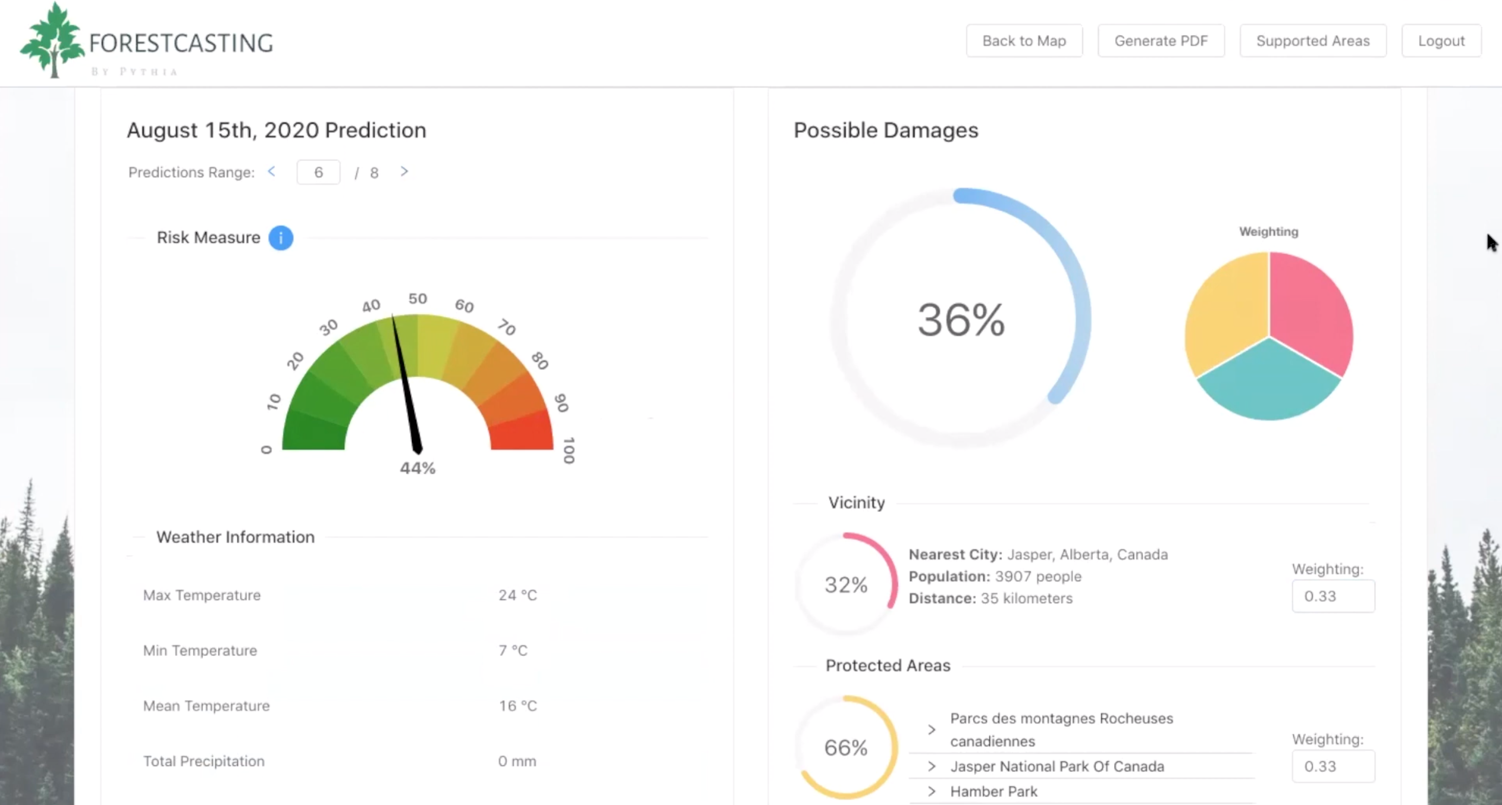
The Forestcasting tool consists of (1) a machine learning model that calculates the probability a forest fire could occur in a given area, and (2) a mathematical damage algorithm that estimates the severity of damages caused by said fire.
No existing forest fire management tool provides such a comprehensive view of both risks and damages.
Explored and compared multiple different machine learning techniques. Chose RandomForestClassifier for its performance.
Based on tree coverage data, vicinity score, and protected areas. Uses min-max scaling and logarithmic normalization. Managers can tune these weights within the application according to their needs.
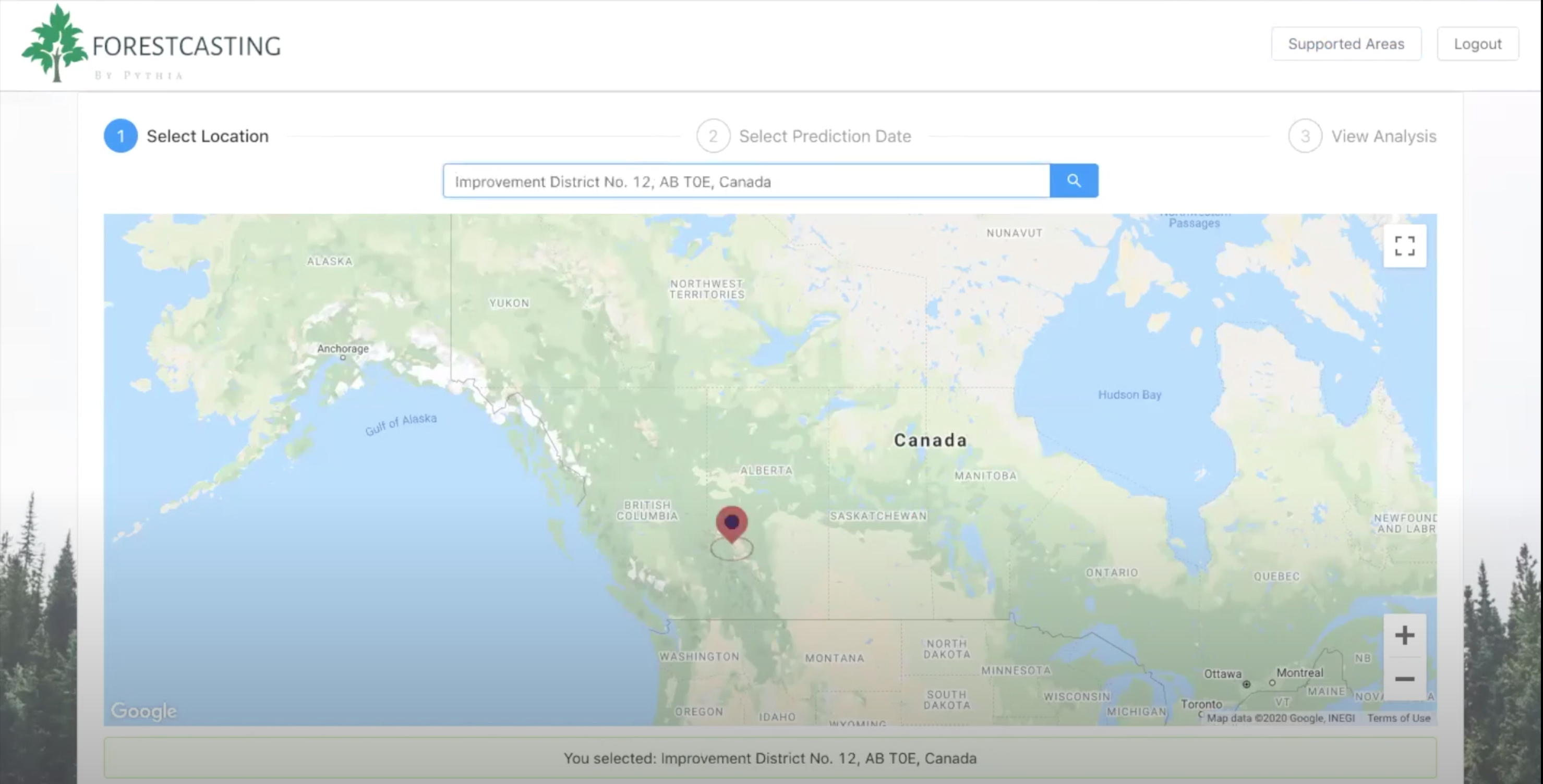
Uses the Google Maps API to provide an intuitive way to select regions in Canada.
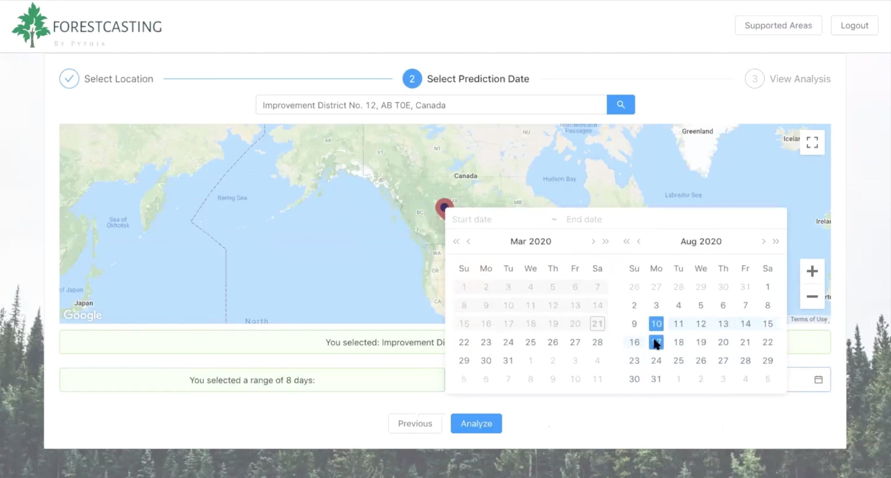
Uses historical weather data to provide predictions up to one year into the future.
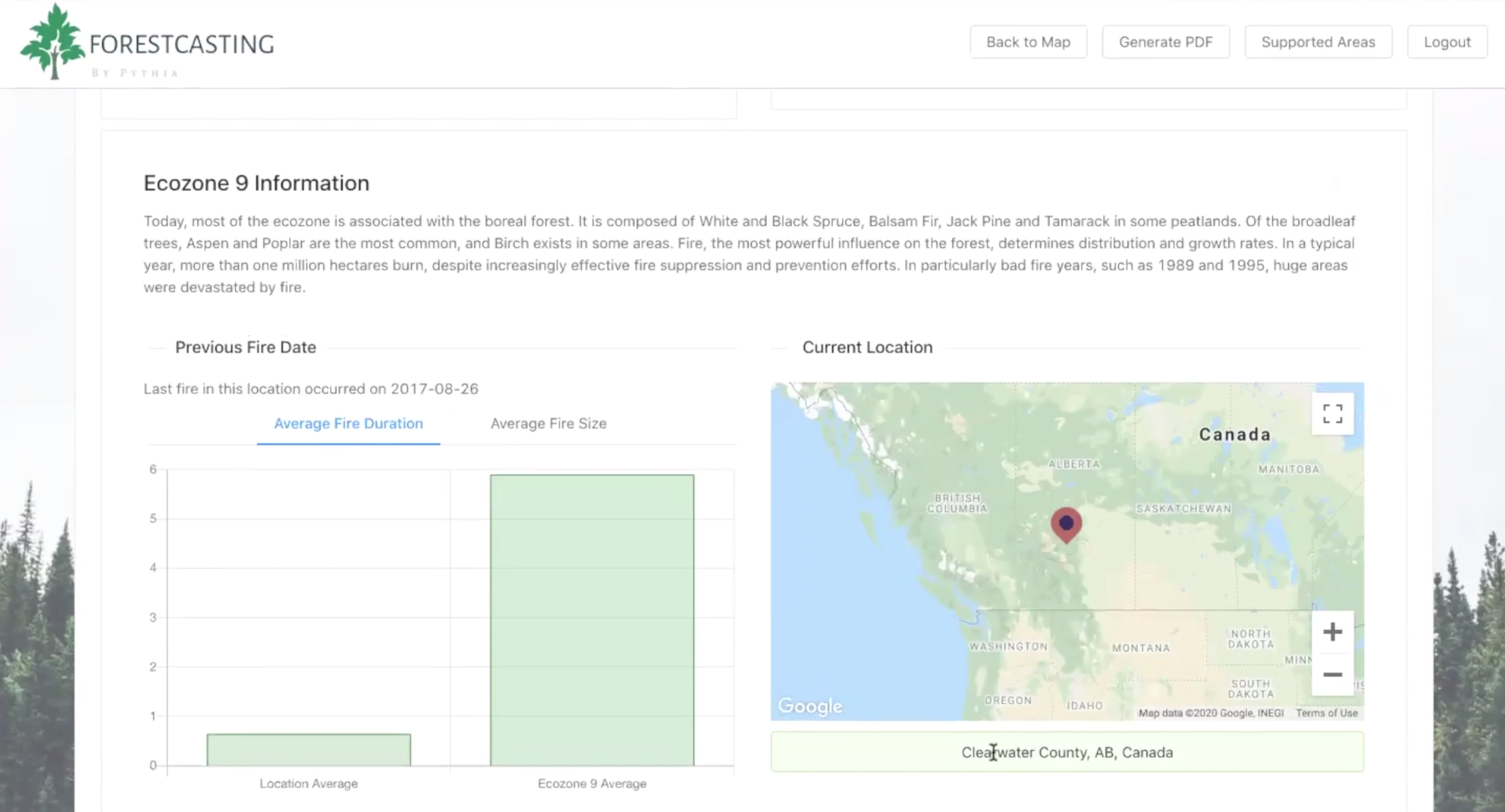
On top of risk and damage prediction, the report provides additional data on weather, ecoregion, previous fire occurrences, nearby population, protected areas, tree coverage, elevation and more!
Divided Canada into 20km x 20km grid locations. Then mapped weather, fire and ecoregion information to that grid. Used an alpha distribution to fill in any missing values.
No existing forest fire management tool provides a comprehensive view of both risks and damages.